Johannesburg OR Tambo International Airport (JNB)
Driving Directions / Travel by Car
(Johannesburg, South Africa)

South Africa's busiest and most important transport hub, Johannesburg International Airport (JNB) is just a short distance from the city. Located on the eastern outskirts of Johannesburg, the airport lies to the north of Boksburg and is also close to Benoni, Germiston and Witwatersrand.
Standing on the northern side of Johannesburg Airport, Kempton Park is a noteworthy town located on the East Rand, in the Gauteng area of South Africa. The R24 Electron Highway is also nearby and stands to the west, running in a north-east / south-west direction, with the N12 to the south and the M39 (Barbara Road) to the east.
Directions to Johannesburg International Airport (JNB) from the city centreTravel along M2 or R24 highway heading east
Johannesburg Airport is located 22 km / 14 miles east of the city
The airport can be reached by travelling out of the city on the M2, and then along the N12 Highway, with clear signposts along this route
When driving to the airport from Johannesburg city centre, the journey is usually around 35 minutes
Directions to Johannesburg International Airport (JNB) from Pretoria
- Travel along the R21 highway heading south
- Johannesburg Airport is located 25 miles / 40 km south of Pretoria
- When driving to the airport from Petroria, the journey is usually around 45 minutes
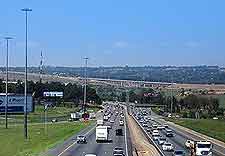
When travelling to Johannesburg International Airport (JNB) during peak commuting times, be sure to allow enough time, in case you meet traffic delays.
 South Africa's busiest and most important transport hub, Johannesburg International Airport (JNB) is just a short distance from the city. Located on the eastern outskirts of Johannesburg, the airport lies to the north of Boksburg and is also close to Benoni, Germiston and Witwatersrand.