Johannesburg OR Tambo International Airport (JNB)
Orientation and Maps
(Johannesburg, South Africa)
The country's most densely populated city, Johannesburg has a population of around five million inhabitants. Johannesburg is also known locally as 'eGoli' or 'Jozi' and is a particularly wealthy city, with plenty for tourists to see.
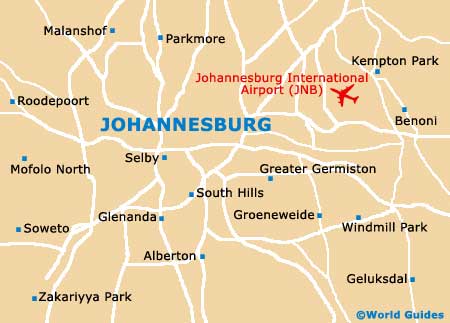
Located on the eastern side of the city you will find the Johannesburg International Airport (JNB), with direct flights connecting many of the world's capital cities. The new Park Station is close to the city centre and is home to a large number of international bus services, which travel to many cities around South Africa, such as Botswana, Mozambique and Zimbabwe, and also links the airport to the city.
Johannesburg International Airport (JNB) Maps: Important City Districts
Although Johannesburg is a large and spreading city, it is easy to travel around, with a number of freeways leading to and from the city. The centre of Johannesburg is laid out as a gridwork of roads and is full of tall office blocks, such as the Carlton Centre located along Commissioner Street, which dominates the area.
Located to the west of central Johannesburg you will find the Newtown neighbourhood. This region of the city was developed as an alternative to the downtown district and offers plenty of hotels, restaurants and shops, being safer at night. Other nearby districts include Brammfontein, which is close to the dangerous neighbourhood of Hillbrow. The northern suburbs of Johannesburg contain several wealthy residential areas, being close to both the N1 and N3 highways.
Africa Map

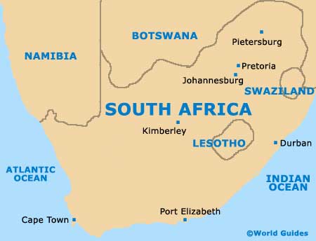
South Africa Map
Johannesburg Map